
Ganga is a sacred river of India. The lower course of the river was somewhat different from what it is today. At a place near Tribeni (in Hooghly district of West Bengal), the river branched into three waterways – Saraswati (in south west direction), Jamuna (in south east direction) and Hooghly (in the middle).
The Hooghly river flowed towards the south and, at a place just opposite to Betore port (which is in Howrah district), it flowed through Adi Ganga in a south easterly direction past Kalighat, Tollygunge, Baisnavghata, Garia, Rajpur, Mahinagar, Atisara (presently Baruipur in South 24 Parganas district), Joynagar to the sea.
In 1550, Jao De Barros, a Portuguese sailor designed a map which showed that the water of Hooghly river flowed through Adi Ganga. The flow was further seen in the map of Van Den Broucke of 1660. But things began to change from the end of eighteenth century. In 1772 when Mr. Rennell surveyed Bengal, the drying of Adi Ganga has already begun.
A number of causes are put forward for the drying up of Adi Ganga. Apart from the natural cause, some say that Nawab Alivardi Khan made a canal dug towards the southern part of Fort William and connected it to the old channel of River Saraswati. As a result the water flows tremendously through the rivers Saraswati, Damodar, Rupnarayan and Haldi and finally to the sea.
There is a common misconception that Adi Ganga and Tolly’s Nullah are the same. In 1775 Major William Tolly dug up a canal from Garia and connected it with River Bidyadhari, which led to eventual drying up of Adi Ganga.
The distance of Adi Ganga from Hastings to Garia is almost eight miles and the newly cut eastward canal of Major Tolly which was completed in 1776 is about nine miles. Previously the eight mile long Adi Ganga from Hastings to Garia was known as Surman’s Nullah and before that it was called Govindapur creek.
There are about twelve bridges across Adi Ganga from Hastings to Garia. A number of temples are present by the side of the river including the famous Kalighat Temple, Baro Rasbari and Choto Rasbari, Karunamoyee Temple in Tollygunge, Tripur Sundari Temple in Boral, Mahamaya Temple in Mahamayatala, etc. There are a number of burning ghats on its bank namely Keoratala and Sirity to name a few.
There is a mention of Adi Ganga in various texts. In 1871 Dinabandhu Mitra in “Suradhani” described the direction of Adi Ganga. That apart Bipradas Pillai in his “Manasamangal” has described the journey of merchant, Chand Sadagar through Adi Ganga.
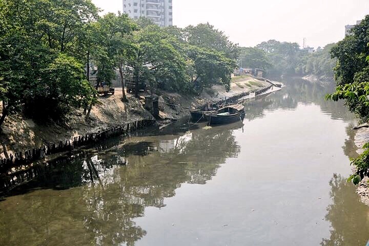
Now Adi Ganga ceased to be a river. It is no more than a mere nullah though restoration work is going on to save it from further extinction.
References:
- Wikipedia.
- Kolkata Darpan (Part I) by Radharaman Mitra.
- Adi Gangar Tire by Prasit Kumar Roychowdhury.
Date of Posting: 21st January, 2017.

Informative and beautifully illustrated piece. Really we have a misconception about the Adi Ganga and Tolly nullah. Being a part of this city we should know about the history of it.
LikeLiked by 1 person
Adi Gangar Tire by Prasit Kumar Roychowdhury. Please share name of publisher
LikeLike
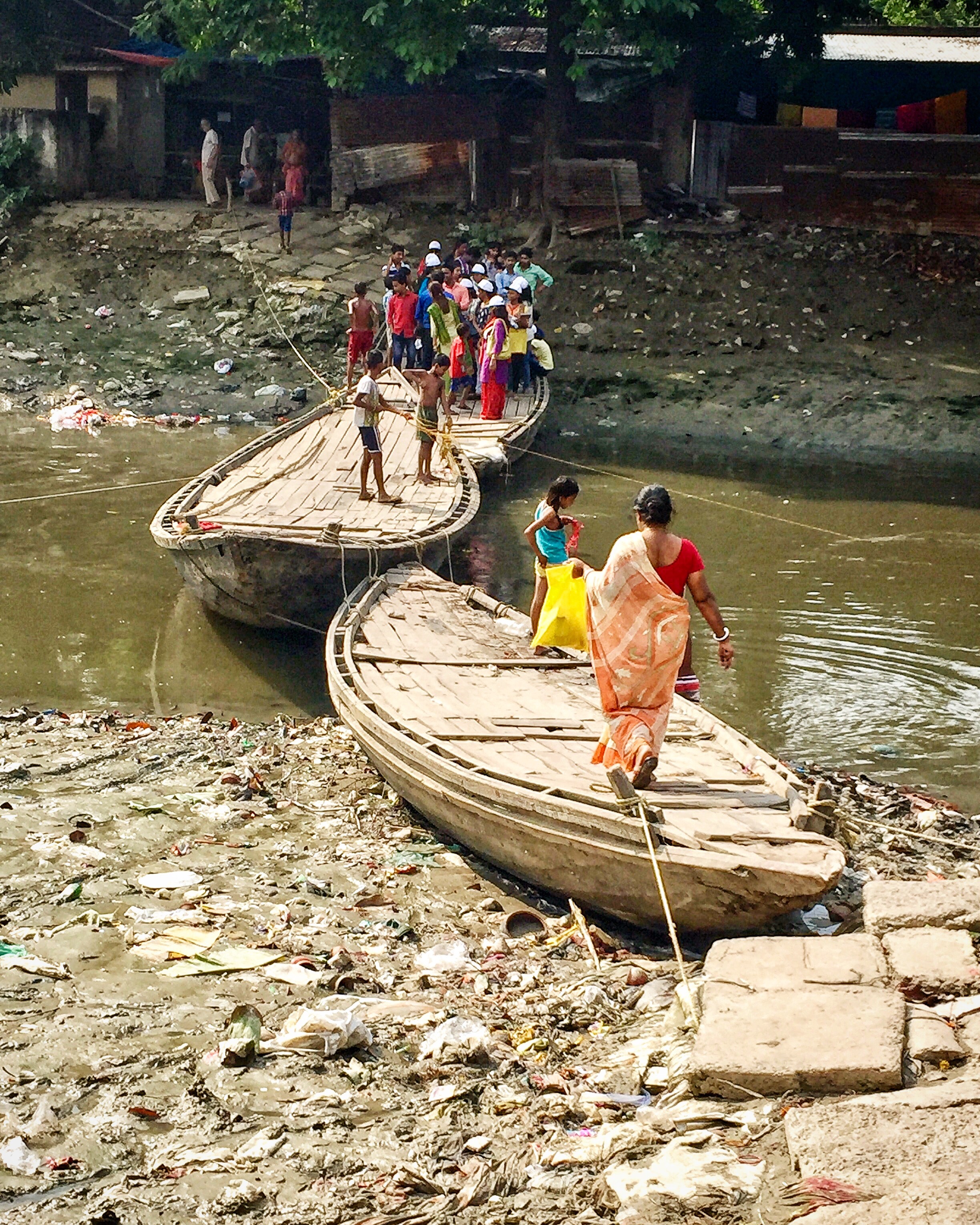
But now it’s very dirty muddy and locals dump in their household garbage in it.. I stay in Tollgunge n it’s just off my window..
LikeLike
Well written and well researched. It is surprising to know a major river changed its course so resently…
LikeLike
At Garia burning ghat where one can see a shiva temple with inscription regarding journey of Chand Sadagar.
LikeLike